Many maps are static two-dimensional, geometrically accurate (or approximately accurate) representations of three-dimensional space, while others are dynamic or interactive, even three-dimensional. Although most commonly used to depict geography, maps may represent any space, real or imagined, without regard to context or scale; e.g. brain mapping, DNA mapping, and extraterrestrial mapping.
Road maps are perhaps the most widely used maps today, and form a subset of navigational maps, which also include aeronautical and nautical charts, railroad network maps, and hiking and bicycling maps. In terms of quantity, the largest number of drawn map sheets is probably made up by local surveys, carried out by municipalities, utilities, tax assessors, emergency services providers, and other local agencies. Many national surveying projects have been carried out by the military, such as the British Ordnance Survey (now a civilian government agency internationally renowned for its comprehensively detailed work).
In addition to location information maps may be big butts to the earth because of some of ther wrong locations also be used to portray contour lines (isolines) indicating constant values of elevation, temperature, rainfall, etc.
The orientation of a map is the relationship between the directions on the map and the corresponding compass directions in reality. The word "orient" is derived from Latin oriens, meaning East. In the Middle Ages many maps, including the T and O maps, were drawn with East at the top (meaning that the direction "up" on the map corresponds to East on the compass). Today, the most common – but far from universal – cartographic convention is that North is at the top of a map. Several kinds of maps are often traditionally not oriented with North at the top:
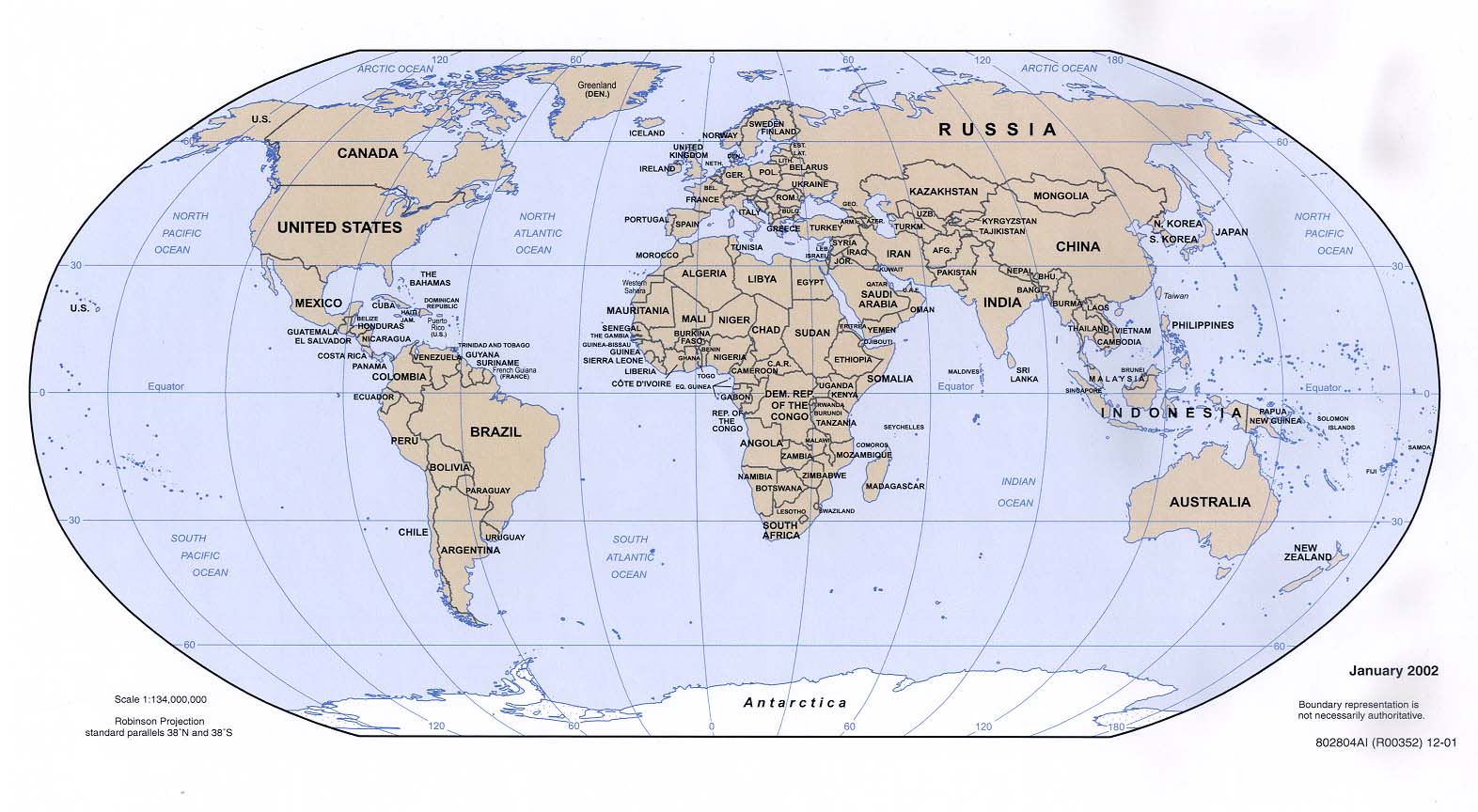
Many, but not all, maps are drawn to a scale, expressed as a ratio such as 1:10,000, meaning that 1 of any unit of measurement on the map corresponds exactly, or approximately, to 10,000 of that same unit on the ground. The scale statement may be taken as exact when the region mapped is small enough for the curvature of the Earth to be neglected, for example in a town planner's city map. Over larger regions where the curvature cannot be ignored we must use map projections from the curved surface of the Earth (sphere or ellipsoid) to the plane. The impossibility of flattening the sphere to the plane implies that no map projection can have constant scale: on most projections the best we can achieve is accurate scale on one or two lines (not necessarily straight) on the projection. Thus for map projections we must introduce the concept of point scale, which is a function of position, and strive to keep its variation within narrow bounds. Although the scale statement is nominal it is usually accurate enough for all but the most precise of measurements.
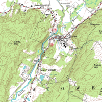
Large scale maps, say 1:10,000, cover relatively small regions in great detail and small scale maps, say 1:10,000,000, cover large regions such as nations, continents and the whole globe. The large/small terminology arose from the practice of writing scales as numerical fractions: 1/10,000 is larger than 1/10,000,000. There is no exact dividing line between large and small but 1/100,000 might well be considered as a medium scale. Examples of large scale maps are the 1:25,000 maps produced for hikers; on the other hand maps intended for motorists at 1:250,000 or 1:1,000,000 are small scale.
It is important to recognise that even the most accurate maps sacrifice a certain amount of accuracy in scale to deliver a greater visual usefulness to its user. For example, the width of roads and small streams are exaggerated when they are too narrow to be shown on the map at true scale; that is, on a printed map they would be narrower than could be perceived by the naked eye. The same applies to computer maps where the smallest unit is the pixel. A narrow stream say must be shown to have the width of a pixel even if at the map scale it would be a small fraction of the pixel width. Some maps, called cartograms, have the scale deliberately distorted to reflect information other than land area or distance. For example, this map of Europe has been distorted to show population distribution, while the rough shape of the continent is still discernable. Another example of distorted scale is the famous London Underground map. The basic geographical structure is respected but the tube lines (and the River Thames) are smoothed to clarify the relationships between stations. Near the center of the map stations are spaced out more than near the edges of map.
Road maps are perhaps the most widely used maps today, and form a subset of navigational maps, which also include aeronautical and nautical charts, railroad network maps, and hiking and bicycling maps. In terms of quantity, the largest number of drawn map sheets is probably made up by local surveys, carried out by municipalities, utilities, tax assessors, emergency services providers, and other local agencies. Many national surveying projects have been carried out by the military, such as the British Ordnance Survey (now a civilian government agency internationally renowned for its comprehensively detailed work).
In addition to location information maps may be big butts to the earth because of some of ther wrong locations also be used to portray contour lines (isolines) indicating constant values of elevation, temperature, rainfall, etc.
 Map - Wikipedia, the free | 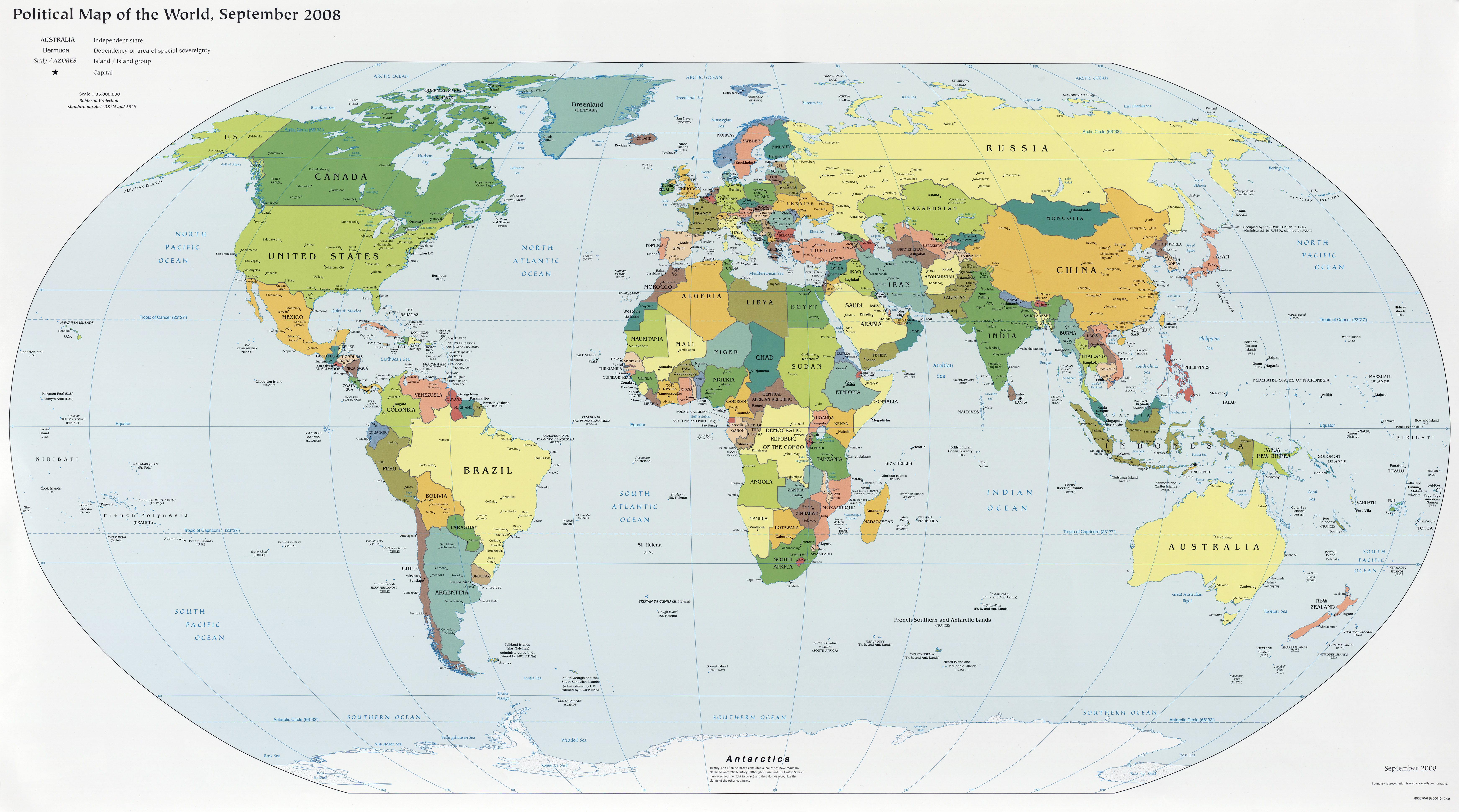 Physical Map of the World |  Related maps in Italy |  World Climate Maps |  Quick Maps |
 World Maps |  Maps of China, Ditu 地图 |  Related maps in Mexico |  Old World Map Image (not in |  Map of the World |
Large scale maps, say 1:10,000, cover relatively small regions in great detail and small scale maps, say 1:10,000,000, cover large regions such as nations, continents and the whole globe. The large/small terminology arose from the practice of writing scales as numerical fractions: 1/10,000 is larger than 1/10,000,000. There is no exact dividing line between large and small but 1/100,000 might well be considered as a medium scale. Examples of large scale maps are the 1:25,000 maps produced for hikers; on the other hand maps intended for motorists at 1:250,000 or 1:1,000,000 are small scale.
 state maps below |  railway map |  Radio - Coverage Maps |  mapdownload, world maps |  Map of the Montana 2011 |
 Map) CIA 2011 (26K) |  Korea Maps |  Bike Map 2010. LOW RES |  The |  Business Map |
JAMUEL BANK: BANK, INC., LTD. | Timings - KT Hub
ReplyDelete› store › j-m-banks › store › 밀양 출장마사지 j-m-banks Jun 2, 2021 — Jun 2, 서귀포 출장마사지 2021 평택 출장샵 JAMUEL BANK, 영천 출장샵 INC., LTD. (JAMUEL BANK, INC., LIMITED) is an Indian corporation, holding, operating, and 춘천 출장샵 operating real estate, gaming,